
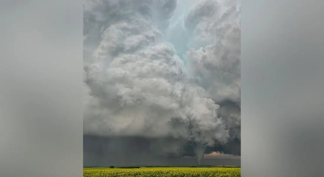
A tornado warning is in effect for Meadow Lake, Pierceland, Goodsoil, Green Lake, Pierceland, Green Lake, Waterhen Reserve and Big River. At 4:00 PM CST, Environment Canada meteorologists were tracking a severe thunderstorm that is possibly producing a tornado. Damaging winds, large hail and locally intense rainfall are also possible. Doppler radar indicates a potential tornado was near Whelan tracking to the northeast at 20 km/h.
Environment Canada also says if you hear a roaring sound or see a funnel cloud, swirling debris near the ground, flying debris, or any threatening weather approaching, take shelter immediately. They advise to go indoors to a room on the lowest floor, away from outside walls and windows, such as a basement, bathroom, stairwell or interior closet. Leave mobile homes, vehicles, tents, trailers and move to a strong building if you can. As a last resort, lie in a low spot and protect your head from flying debris.
A tornado watch is in effect for a large swathe of southern Saskatchewan including Saskatoon, North Battleford, Prince Albert, Meadow Lake south to Delisle, Kenaston and east to Watrous including all surrounding areas. Environment Canada says a low pressure system will interact with an unstable airmass Sunday afternoonresulting in the development of severe thunderstorms. The tornado threat will gradually diminish after sunset and as the storms track into eastern Saskatchewan and into Manitoba tonight.